
Decoding the United States Interstate Number System
Decoding the United States Interstate Number System
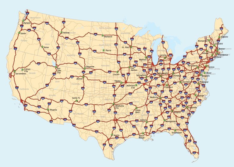
The United States Interstate Number System is a marvel of logical design, ensuring that travelers and logistics professionals can easily navigate the vast network of highways that crisscross the country. At first glance, it might seem like a random collection of numbers, but there's a method to the madness. Let's dive into the fascinating world of interstate numbering and discover the patterns and rules that govern this system.
The Basics of Numbering
The United States Interstate Number System starts with some foundational rules:
- Primary Interstates: These are the main highways that connect major cities and regions. They are given one or two-digit numbers. For instance, I-10 or I-95.
- Loops and Spurs: These are secondary roads, often encircling a city or branching off a primary interstate. They are assigned three-digit numbers, reflecting their parent road. For example, I-495 or I-270.
Directional Numbering
The direction in which the interstate runs plays a crucial role in its numbering:
- East-West Routes: These are given even numbers. The more to the west or south the road starts, the lower its number. As you move eastward, the numbers increase.
- North-South Routes: These are assigned odd numbers. The numbering starts low in the south and increases as you head north.
Significance of Zeroes and Fives
The most significant cross-country interstates, the ones that span vast distances and connect major coasts or borders, are given numbers divisible by five. These end in either zero or five. For instance, I-95 runs along the eastern coast, while I-10 stretches across the southern part of the country.
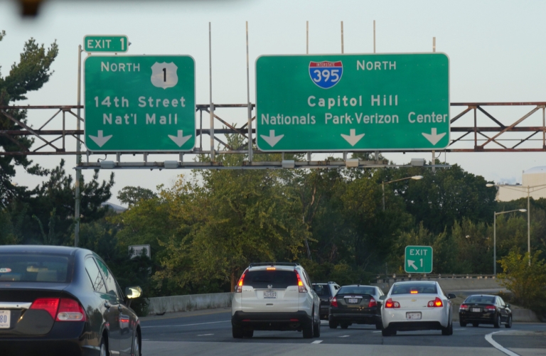
The Three-Digit System
Three-digit interstates serve specific metropolitan areas. They connect to the primary two-digit routes and can act as bypasses, spurs, or connectors. The numbering for these roads follows two main rules:
- The last two digits mirror the primary two-digit interstate they connect to. For instance, I-395 connects to I-95.
- The first digit indicates the road's purpose. Even first digits usually denote loops or bypasses that intersect with their primary interstate at two points. Odd first digits typically represent spurs or connectors that intersect once.
Exceptions and Oddities
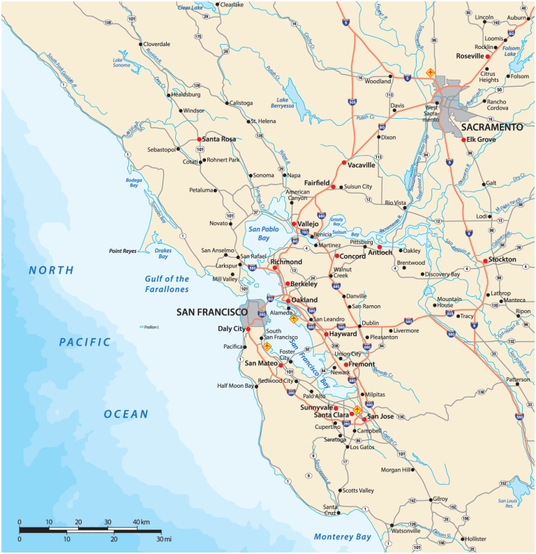
Like any system, there are exceptions. For instance, I-238 in the San Francisco Bay Area doesn't connect to an I-38, as one might expect. Instead, it's a connector between I-580 and I-880. Similarly, Maryland's I-270, which should ideally have an odd first digit, has an even one.
Interstates Beyond the Mainland
Interestingly, even regions without direct land connections to the mainland US, like Hawaii, Alaska, and Puerto Rico, have interstate highways. These roads have lettered prefixes: H for Hawaii, A for Alaska, and PR for Puerto Rico. Their numbering is more straightforward, starting sequentially from 1. For example, Hawaii's first interstate is H1.
The United States Interstate Number System, with its blend of logic and exceptions, reflects the country's vast and varied landscape. Next time you're on the road, take a moment to appreciate the thought that went into naming the very highway you're traveling on.